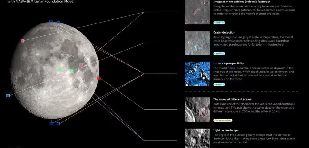
When a SpaceX Falcon 9 rocket slammed into the Moon on August 5, IBM fed an image of the impact site to a newly built AI model, and the system correctly identified the crash as a new crater on the first try, even though it overlapped with an existing one. That’s a good demo. But the more interesting story here is what NASA and IBM built to make it possible.
The two organizations have released the NASA-IBM Lunar Foundation Model, an open-source system available on Hugging Face. It was built to process imagery and instrument data from the Moon’s surface, and it was tested against SwinV2-B, a Microsoft-trained vision model commonly used as the baseline for image analysis tasks. On ice detection, the NASA-IBM model reduced errors by 23 percent compared to SwinV2-B. On crater identification and classification, it outperformed the Microsoft model by 19 percent while using half the training data. Those are not small margins.
Training the model required solving problems that don’t exist in Earth observation. On Earth, the atmosphere scatters sunlight and softens shadows. On the Moon, shadows are pitch black, and shadowed pixels carry zero information. A crater photographed in morning light looks completely different from the same crater photographed at noon. The standard approach to training computer vision models, where you mask part of an image and ask the model to reconstruct it, failed badly here. Because so many craters look alike from orbit, the model had no reliable way to reconstruct masked sections. IBM describes those early attempts as a “complete disaster.” The fix was to divide the Moon into wedge-shaped sections, like slicing an orange, and fully separate the training wedges from the testing wedges. That gave the model geographic consistency it couldn’t get otherwise.
So far this reads like a solid applied AI story. But the part that may have longer-term consequences is the dataset. NASA and IBM are also releasing a first-of-its-kind open-source collection of tens of thousands of images and instrument readings from NASA’s Lunar Reconnaissance Orbiter, the GRAIL mission, and Japan’s SELENE spacecraft. The data is organized into a grid where every imaging pixel is aligned with other data modalities, giving researchers a co-registered dataset with over two million data points. That kind of structured, multi-source lunar dataset has not existed publicly before.
Dr. Juan Bernabé-Moreno, director of IBM Research Europe, put it plainly: “AI models get superseded by other models. The data is what really creates the industry of AI models.” That framing is worth taking seriously. Foundation models in specialized scientific domains are only as good as the data used to build them, and the lack of well-organized lunar data has been a genuine bottleneck.
This release lands at an interesting moment. NASA’s Artemis II mission completed its lunar flyby in April, sending four astronauts farther from Earth than any humans before them. Artemis III, which aims to land astronauts near the lunar south pole, is next. Ice detection in that region is directly relevant to planning surface operations and potential resource use. A model that gets better at mapping those ice deposits has real operational value, not just scientific interest.
For developers and researchers working in geospatial AI or planetary science, the dataset alone is worth examining. The model is a useful starting point, but what IBM and NASA have really contributed here is infrastructure.