Blackshark.ai
Creates photorealistic 3D digital twins from satellite imagery using AI
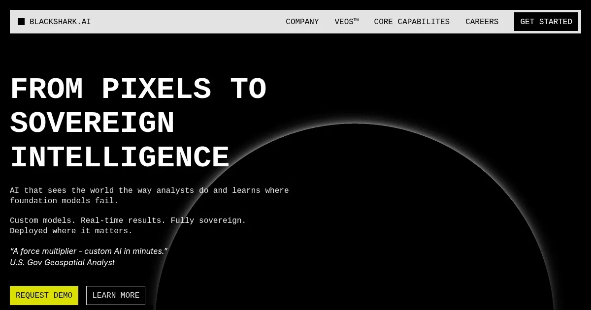
Blackshark.ai is a geospatial AI platform that generates real-time 3D digital twins from satellite and aerial imagery, enabling object detection, feature extraction, and terrain reconstruction for industries like defense, urban planning, and simulations. The core VEOS system handles ingestion of multi-resolution data including raster, LIDAR, and DSM without preprocessing, supporting batch processing of petabyte-scale repositories. HUNTR facilitates custom computer vision model training in minutes for detection tasks, while REPLIKA transforms outputs into scalable 3D environments compatible with Unreal Engine. Deployment options include SaaS, on-premises, air-gapped, and edge setups, ensuring sovereign compliance and optional cloud dependency.
Key features encompass pixel-agnostic ingestion for any sensor or band, analyst-operated controls for model reusability and sharing, and interpretable AI for decision transparency. Compared to competitors such as Esri ArcGIS and Google Earth Pro, it excels in rapid AI training and 3D procedural workflows but may require more expertise for optimal use. Pricing is custom, often tailored to enterprise needs, which can be more flexible than subscription models from rivals like Orbital Insight.
Users benefit from real-time monitoring and mapping with mission precision, extracting insights for applications in government policy, autonomy systems, and infrastructure management. Testimonials highlight its role in equipping teams with precise data, as seen in Anne Arundel Countys adoption for GIS enhancements. However, high computational demands pose challenges for resource-limited setups.
The platform adapts to diverse missions, from national defense to environmental classification, with collaborative acceleration through mission-specific libraries. Integration with existing GIS workflows and tools like ArcGIS supports seamless exports, though initial setup might involve configuration. Recent updates, such as partnerships for UAE digital twins and AWS ICMP listing, expand its federal and regional applicability.
Practical advice includes starting with pilot projects on familiar datasets to assess fit, then leveraging model libraries for accelerated deployments in critical sectors.
Homepage Screenshot 📸
Video Overview 🎬

What are the key features? ✨
- VEOS: Orchestrates ingestion, training, detection, 3D reconstruction, and export for geospatial data.
- HUNTR: Trains custom AI models for object detection on any imagery in minutes.
- REPLIKA: Transforms imagery into scalable 3D environments for simulations and digital twins.
- Ingestion: Handles multi-source data like satellite, drone, LIDAR without preprocessing.
- Deployment: Supports sovereign options including on-prem, air-gapped, and edge setups.
Who is it for? 🤔
Examples of what you can use it for 💡
- Geospatial Analyst: Trains models to detect and classify objects in satellite imagery for mission monitoring.
- Simulation Engineer: Reconstructs 3D terrains from detection results for synthetic training environments.
- Urban Planner: Extracts features for land use and zoning analysis across city-scale datasets.
- Government GIS Team: Deploys sovereign workflows to assess damage post-disaster with real-time updates.
- Autonomy Developer: Generates attributed 3D spaces to test visual sensors in digital twins.
Pros & Cons ⚖️
- Rapid model training
- Sovereign deployment
- Real-time 3D reconstruction
- Multi-source data fusion
- High compute needs
- Expertise required
FAQs 💬
Ready to try Blackshark.ai?
Creates photorealistic 3D digital twins from satellite imagery using AI
Visit Blackshark.ai